Hike around the Oderteich near Sonnenberg
- Written by Portal Editor
We were on our way back from Braunlage to Clausthal-Zellerfeld in the early afternoon when the wonderful sunshine, despite the forecast for rain, forced us to stop at the Oderteich car park.
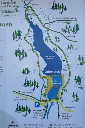
As quickly as the stop was made, the hiking boots were put on, the packed backpack shouldered and off we went. And it was really a wonderful tour, because there are hardly any significant inclines, it takes about 1.5 to 2 hours and is therefore really recommended for trips with children. However, the tour, which partly runs on narrow boardwalks and often on root paths, is not really suitable for wheelchairs or prams. Good hiking shoes are quite helpful, especially on the root paths.
Oderteich - great importance for electricity generation to this day

In 1703 the New Rehberger Graben was completed, which led Oderwasser to Sankt Andreasberg. This significantly improved the supply of water to the mines there, but the Oder could not supply enough water after a long period of drought. This triggered considerations of further improving the power water supply by installing a large water reservoir. Ten to 15 kilometres to the west, in the Clausthal-Zellerfeld and Hahnenklee area, 50 to 60 small dam structures were already in operation at that time. However, the architectural style there could not be copied because the sod used to seal the building was not available in the vicinity of the Oderteich (we have published the following article on this: Sod sealing in the dam core of the pond).

In 1712, Vice Miner Caspar Dannenberger wrote two letters to the Clausthal Mining Authority and suggested building the Oderteich dam out of granite masonry with a granite grout seal. This suggestion was implemented. First, a foundation ditch was dug to which the dam seal was connected. The granite stones and granite sand required for the masonry on the water and air sides were extracted from small quarries in the future storage area. As a result, the future pool capacity could be increased at the same time. The work lasted until 1722. Since floods could neither be dammed nor drained via the - relatively small - dimensioned bottom outlet during the construction period, a flood relief system (outflow) had to be constantly available, which grew with the dam.
Mining in Sankt Andreasberg came to a standstill in 1913. From then on, the systems of the Upper Harz water regime were used to generate electricity: the water from the Oderteich continues to flow to Sankt Andreasberg and is used there in several power plants, especially in the Samson pit. This ensures the economic operation of the Oderteich and Rehberger Graben to this day. Today, the companies Harz Energie and Eckold are among the lessees.
In contrast to many (unfortunately) shut down hydroelectric power plants, the ancient Harz water systems still provide a reliable power and water supply today, which should not be underestimated in the course of the current energy supply discussions about supply and dependencies on fossil fuels.
Back to the tour around the Oderteich
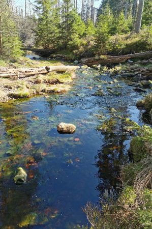
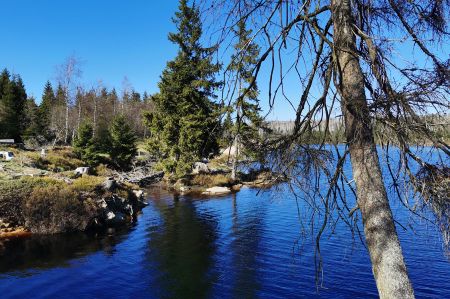
The path along the bank of the pond is a bit bumpy at first, because tree roots sometimes cross the path so extremely that it is easy to stumble. This is where the right footwear comes into play. There is a parallel gravel path (for cyclists on the Harz tours), which is less interesting. What is there to see along the way: fauna and flora around the Oderteich, the imposing dam wall at the end of the circular route, spruce forest with some of the oldest spruce trees in the Harz National Park (300 years), high moor areas, forest development into mixed forest, the tributary of the Oder to the reservoir. And of course, a stamp, here the number 217. Incidentally, other hiking routes cross here, also in the direction of Torfhaus and Oderbrück or alternatively in the direction of Altenau and Wolfswarte. An idyllic place for a short stopover.
A short hike around the Oderteich, which we would like to repeat when the opportunity arises.
Please also read:
Heracleia Lyncestis - a day trip to Bitola
Istanbul - Marmaray-Eisenbahn-Tunnel eröffnet
-
-
-
-
-
-
-
-
-
-
-
-
-
-
-
-
-
-
-
-
-
https://www.alaturka.info/en/hiking-tours/6076-hike-around-the-oderteich-near-sonnenberg/amp#sigProId4ef350686f
