Anatolia - Surrounded by Mountains
The eastern part of the Taurus Mountains consists of massive rocks stretching from the West and increasing in height to the East.
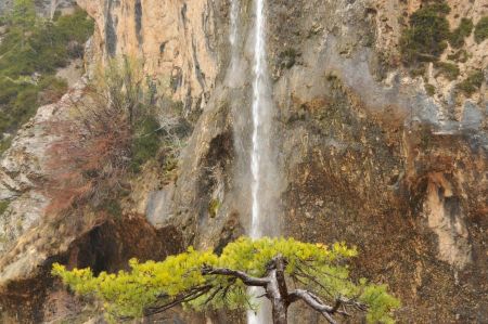
The difference in height between peaks and plateaus like Higher Mesopotamia at Diyarbakir, Mardin and Şanlıurfa due toactive erosion and huge natural crevices can be up to 3.000 metres. The River Euphrat has eroded deep canyons into the mountains and through its whirling motion the water has found its way through rocky areas.
Because of the river, a relatively big part (about 20%) of the country is cultivated with wheat, barley, wine, olives and pistachios. The percentage of production for the home market is very small. East of the Euphrates area there is the Mardin Plateau on which up to 50% or even 70% of the land is cultivated. Wheat and barley are the main crops. All other parts of the region are much less cultivated, only between 10 - 20%, and used just for summer grazing for the cattle or small, privately-owned gardens, like everywhere in high mountain areas.
Centre of Anatolia - Surrounded by the Mountains
Surrounded by the mountains of the coastal areas and defined by them we will find the plateaus of Central Anatolia. There is not one big plateau. The area is divided into three different geographical heights, none of them less than 800 metres above sea level; there is a flat plateau between 800 - 1500 metre with deep valleys and basins in the flat areas about 100 - 300 metres deep, quite often with a lake like Tuz Gölü, a salty lake without a river outflow; then there are 200-metre-high massive rocks like Emir Dag and Türkman Dag or volcanic mountains like Erciyes Dag with peaks reaching 3.900 metres. The continual erosion of the rivers draining to the Aegean Coast shaped the landscape of the western part of Central Anatolia much more. The south is marked by 2.600-metre-high mountains in whose valleys lots of still-water lakes have been formed like we find at Burdur, Egridir and Beysehir.
Where the mountains become a little higher, we find Cappadocia, a landscape covered with mountain cones more than 2.00 metres in height, followed by huge flat valleys bigger than the valley of Kizil Irmak. The eastern part of Cappadocia is a flat steppe of 1.300 metres in height while, to the south, volcanic activity is much more responsible for the shapes traced into the whinstone. The most well known towns in this fabulous landscape are Göreme and Urgüp, both of them belonging to the Kayseri region.
The centre of Anatolia does not have any rivers and because of that is one of the driest and most scantily vegetated areas in the whole of Anatolia. The earth on the top directly in the sun's rays is covered with layers of salt. The lake of Tuz Gölü, between Ankara and Sultanhan, is the same size as the German Lake Constance but is much more salty than the Dead Sea.
While in most of the regions we have described there still is a lot of productive forest, there is nearly no forest in the centre of Anatolia. Because of its climate huge parts of central Anatolia are quite unproductive, just 20% being used. Primarily, farmers grow wheat. Some of them grow winter-resistant fruits like apples, others try vines or even peaches. The plateaus of the area belong to the 50 - 70% of cultivated lands of Turkey where they produce wheat and barley using industrial machinery.
Like everywhere in Turkey another important part of the local economy is the breeding of sheep, along with the breeding of Angora goats. Solely because of that and despite its geographically isolated position, this area makes a positive contribution to the Turkish economy.
