Gazipaşa - Antiocheia ad Cragum - castle hill near Selinus
- Written by Portal Editor
About 18 kilometers east of Selinus, which is now known as Gazipasa, the ancient city of Antioch ad Cragum once stood high on the rocks above the sea.
The ancient city, which locals call Nohutyeri, is located south of coast road 400, about 60 kilometers from Alanya, on the outskirts of Güney village. After leaving the country road 400 (follow the sign to Güney) you will reach the ruins of a columned street after about 3 kilometers. After a short stopover, you will reach the coast after about 5 more kilometers and see the former rock city right in front of you.

Ad Cragum means "on the mountain / rock", no wonder, because the city is about 300 meters above sea level. Even before the city was founded, there must have been a smaller settlement or even a castle here, because Greek traces were also found. The pirates of pre-Christian times used the Felsenburg for their purposes as early as 67 BC. A natural harbor, which could be reached through a cave in the rocks, offered optimal escape routes and protection from pursuers. In this way, the pirates were able to stay in the region for a long time. Unfortunately, we were a little unlucky with the weather, because dark clouds rolled in from the sea and even a hurricane developed.
Hospitallers and Crusaders in Antioch ad Cragum

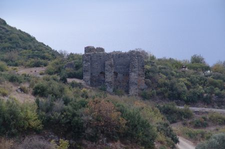
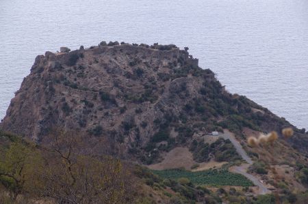
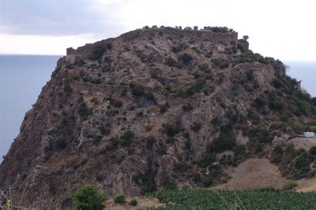
The ruins are divided into three larger areas over the large area. To the east is the city proper with the remains of administrative and religious buildings, the acropolis and the necropolis, dating from Roman and Byzantine times. On the peninsula about 1 kilometer to the west, there are some indefinable ruins that may have belonged to a castle complex. On the high promontory there are remains of a large Romano-Byzantine fortress called Antikragus, which the Turks called Ortacag Kalesi.
The city gate and triumphal arch convey the impression of the greatness that once existed
Just south of the ruins, between the mainland and a small island, there has been an anchorage for centuries, as indicated by finds of anchors and amphorae dating back to the 5th century BC.
Access to the medieval fortress in the west requires mountaineering skills and a lot of time, but it is an exciting tour with fantastic views. Northeast of the castle there used to be a harbour, as evidenced by the 53 stone, iron and lead anchors found on the seabed. Many of the anchors date from the Byzantine era and from the 7th - 10th centuries.
Please also read:
Jever – old town festival and castle visit
Prague - walking tour through the historic old town
-
-
-
-
-
-
-
-
-
-
-
-
-
-
-
https://www.alaturka.info/en/turkey-country/riviera/1650-gazipasa-antiocheia-ad-cragum-nohutyeri/amp#sigProIdd60c148c83
