Another day trip to Imotski Dolines
- Written by Portal Editor
During our first stay to visit the two sinkholes in Imotzki we had not found the time to concern ourselves with the place itself.
Imotski is located in the Dalmatian hinterland just behind the Mountain range Biokovo, the distance to the Adriatic Sea is 50, to Split 100 km. The border with Bosnia and Herzegovina is only seven kilometers away. The town lies on the flank of a mountain on the edge of a fertile Karst basin called Imotsko Polje.
Archaeological finds prove that the area was inhabited in the Neolithic period. From the 10th century BC the Illyrian tribe of Dalmatians (Delmats) settled here. In Roman times the trade route between Salona and Narona passed the former Emania which was more of a rest stop for travelers than a village.
There are indications that the fortress Imotski can be seen as the nucleus of the present town as early as the reign of Trpimir I., originated 845-864. First mentioned inscription is "De Administrando Imperio" of the Byzantine Emperor Constantine VII. from the mid-10th century which is called Emotha. Whether at that time there was a town outside the fortress walls or not, is not known.
Subsequently Imotski changed hands many times, was ruled by Hungary, Bosnians, Serbs, and the Byzantines. As in 1493 Imotski came under Ottoman rule, the fortress which was now called Topana, was expanded due to its border location. In the 17th century about 1,000 people lived in the fort and the surrounding villages. In Venetian-Austrian War against the Turks, Imotski fell on August 2nd 1717 after a short siege of Venice, which was confirmed in 1718 Treaty of Passarowitz Henceforth. Imotski shared the fate of the rest of Dalmatia.
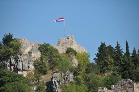
Gradually, the fortress Topana fell after they had been abandoned by the Austrians that they had taken over by the Venetians. It was used as a quarry by the residents of the growing city. Only the remains are conserved today. After the withdrawal of the Turkish the inhabitants added an angel to the entrance off the 1718 built Church of the Holy Virgin. Due to its exposed position, the fortress offers a magnificent view over the city and the Imotsko Polje. Topana is located at the top of the almost 300 meters deep doline, which is filled from the Blue Lake. A comfortable path leads down into the karst boiler down to a viewing platform at the lake.
Interesting due to its location is the football stadium, which was built in 1987-1989 into a sinkhole below the fortress.
Beneath the fortress a staircase by the Venetians leads to the newer parts of the city. At its end the monument created by Kruno Bošnjak for the Croatian poet Tin Ujević is to be seen.
Near the city you can find the earlier Bogomil grave stones (Stecci), about which we have reported already.
What was extremely interesting for us was the visiting of the EKO farm, located almost on the border with Bosnia and Herzegovina, which is worth another item. Be excited: ecological goods manufacture at the entire village.
https://www.alaturka.info/en/croatia/imotski/3004-another-day-trip-to-imotski-dolines#sigProIdc6f2cb4fbe
Please read as well:

