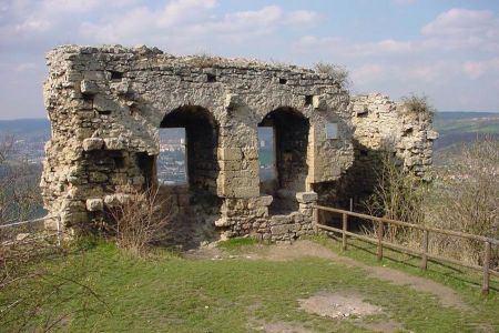
Hike to the ruins of Kunitz Castle, Castle on Gleißberg
- Written by Portal Editor
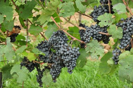
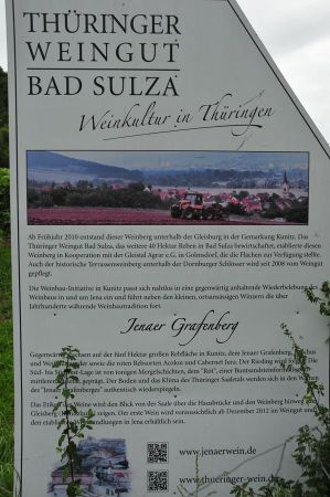
After crossing the wooden covered bridge in Kunitz, we had taken the path into the village center, then walked up the path to the Gleißberg, which first leads us along some wine fields.
While the ascent to the Jenzig mostly takes place on asphalted paths, the trail up to Kunitz Castle ruins is rather a real hiking trail, which impressively reflects the diversity of the local nature, please also read the article "Flora at the path up to Kunitz Castle", which shows the splendor of flowers right on the path.
About the history of the Kunitzburg on Gleisberg
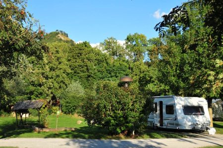 The Gleißberg Castle, today most commonly called Kunitz Castle related with the Kunitz district of Jena, is the ruin of a Castle at 300 m above sea level, five kilometers north-east of the city Jena at the northern end of the so-called "Horse Shoe", which extends from the height Jenzig up to the castle ruin at the Gleißberg.
According to the well-known historian J.C. Zenker the first owners of the castle probably were the Lords and Voigt of Gleißberg. A Voigt Erwin von Gleißberg built a castle on the Veitsberg in 974. Another Lord von Gleißberg, Walther von Gleißberg, brother of the "feisty" bishop Hildeward von Naumburg, donated the cloister to Erfurt in 1036. On July 9th, 1075, Herman von Glizberg decided the battle at the monastery of Homburg, a family tribe known in the region.
In his research on the history of the Franconian aristocracy of the Reginbodons, Wolfgang Hartmann starts from the existence of an "Ekberts von Gleissberg" and sees in him the father "Liutolds von Gleißberg" and brother Berthas (the founder of the monastery Bürgel and wife of Margrave Heinrich von Groitzsch ). To this branch of the Reginbodonen he assigns also the nobles of Camburg, the Burggrafen of Kirchberg-Kapellendorf and other families of the environment.
 Supposedly, the Roman-German king Rudolf of Hapsburg destroyed the Castle of Gleissberg in 1289/90, when he had destroyed 66 castles (60?) To recover Reichsland in Thuringia. A document dated December 17, 1293, issued by Walter IV von Gleissberg at the castle, however, makes this seem unlikely.
From the reciprocal claims which the Wettinians and the Bohemian kings raised, at the same time the German Emperor, in Charles IV, the Margraves were the victors.
On the 8th of March, 1450, Duke William of Saxony gave his advice Apel Vitzthum to Roßla and his brothers Busso and Burkhard as well as Friedrich von Witzleben with Gleißberg, with the obligation to repair the completely desert and decayed castle. The Vitztume played an important role in Thuringia during this time. The duke was probably very close to them. Taking advantage of his confidence, they accumulated riches and possessions to the detriment of the Duke. In 1450 a break broke out, when Wilhelm recognized the true role of the Vitztume. They were expelled from the country.
 Wilhelm of Saxony allied himself with the cities of Erfurt, Nordhausen and Mühlhausen, and stormed the castle of Gleissberg in 1451. The Vitzume had repaired the castle, as far as this was possible in the short time. After the storming of the castle the Bergfried was demolished in 1453. For a short time an official was sitting in the castle. But there was no reconstruction and the castle remained a ruin.
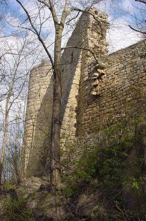
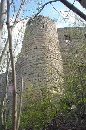
Only a few remains of ruins are preserved from the castle, including the wall of a residential building, a half-tower, small remains of the circular wall with buttresses, the stump of a round mountain fountain, and a partly excavated castle fountain. In the north and west, the castle is secured by an extreme steep slope and to the south and east by deep moats separating a forerun from the main castle.
Beautiful hiking trail up
 Accurate dating by means of comprehensive archaeological discoveries or building investigations are not yet available. Private literary finds, especially ceramics, can be dated only generally in the 12th to 15th centuries. The massive residential building directly above the steep rocky slope would have been erected or rebuilt only after 1300 due to two sitting window windows with two-lane rectangular windows, which were used in Thuringia during this time. The origin of the Bergfried is to be classified between 1200 and 1250.
Although the ruin is perhaps disappointing, at least as far as the size of the ruins is concerned, the hiking trail up Kunitz through Buchenwald is highly recommended, especially as some benches and tables invite to a picnic. And if you would like to go further, the path to Jenzig and the descent to the campsite is recommended.
Hike to the Kunitzburg Ruins – The Forgotten Castle on the Gleisberg - more details
Tucked away in the dense forest of Thuringia, the ruins of Kunitzburg Castle sit enthroned on the Gleisberg, high above the Saale Valley. Once an imposing fortress, it is now a popular destination for hikers and nature lovers. But what lies behind the remains of this medieval castle?
In this article, we take you on an exciting journey to Kunitzburg Castle, explore its history, the most beautiful hiking trails, and give you valuable tips for your visit.
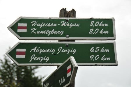
 The ancient structure aroused the interest of hikers and local enthusiasts many decades ago. From the ruins themselves and several points on the path leading there from Kunitz, there are expansive views of the Saale Valley. However, the excursion to Kunitzburg Castle is only possible via forest paths and on foot or by mountain bike. The shortest route from Kunitz leads for just under 1.8 km on narrow, steep, and partly natural paths and has an ascent of about 200 m; its use requires sufficient physical ability. The less strenuous route is approximately 3.3 km, taking the Kunitz–Laasan road and the forest road that branches off about 1.5 km from Kunitz. These paths are intensively used for recreational sports, especially the continuation over the horseshoe to Jenzig (distance from Kunitzburg Castle about 7 km).
1. Kunitzburg Castle – A Mystical Place with a Rich History
1.1. Where is Kunitzburg Castle?
Kunitzburg Castle is located on the Gleisberg, about 350 meters above sea level, near Jena in Thuringia. From here, there are breathtaking views of the Saale Valley and the surrounding forests.
1.2. When was the castle built?
The castle's origins probably date back to the 12th century. It was built by the Lords of Lobdeburg, who controlled large parts of the region at that time.
1.3. The Decline of the Castle
After several military conflicts, Kunitzburg Castle was finally destroyed in the 15th century and never rebuilt. Today, only the ruins remain, testifying to the fortress's former grandeur.
2. The Hike to Kunitzburg Castle – A Nature Experience for Young and Old
2.1. Starting Point of the Hike
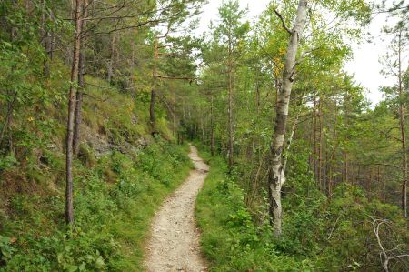 The hike to Kunitzburg Castle begins in the idyllic village of Kunitz, located on the banks of the Saale River. The trail leads you through dense forests, past impressive rock formations, and repeatedly offers spectacular views of the surrounding area.
2.2. Hiking Route to Kunitzburg Castle
- Length: approx. 3 km (one way)
• Duration: approx. 1 hour
• Difficulty: Medium (some steep climbs)
The trail is well signposted and offers numerous rest stops. The hike is a real highlight, especially in autumn, when the leaves glow in warm colors.
2.3. What awaits you at the castle ruins?
Once at the top, you'll be rewarded with a fantastic panorama. The remains of Kunitzburg Castle consist of a few fragments of the walls, but the magic of the place is undeniable.
3. Myths and Legends surrounding Kunitzburg Castle
3.1. The Treasure of Kunitzburg Castle
According to legend, a secret treasure is hidden deep within the Gleisberg. Many treasure hunters have searched for it – but it has never been found.
3.2. The Ghost Girl of Kunitz Castle
Another legend tells of a young girl who is said to have lived in the castle and still wanders through the ruins at night. Those who listen carefully can supposedly hear her whispering in the wind.
4. Why a trip to Kunitzburg Castle is worthwhile
 ✔ Pure nature – The hike leads through beautiful landscapes.
✔ Historic ambiance – The ruins will transport you back in time.
✔ Breathtaking view – From the summit of the Gleisberg, you have a unique view of the Saale River.
✔ Insider tip – Kunitzburg Castle is uncrowded and offers a peaceful atmosphere.
5. Tips for your visit
5.1. Best time of year for a hike
- Spring: Blooming nature and pleasant temperatures.
• Autumn: Colorful forests and great photo opportunities.
• Winter: Mystical atmosphere with snow-covered ruins.
5.2. What should you bring?
- Sturdy shoes (the path can be slippery in places)
• Drinks and snacks (no refreshment stops on the mountain)
• Camera for unforgettable shots
5.3. Getting to Kunitzburg
- By car: Parking in Kunitz
• By public transport: Bus connection to Kunitz, then on foot
Conclusion: A perfect destination for nature lovers and history buffs
The hike to the Kunitzburg ruins is a true experience for anyone who loves nature and history. Whether you want to enjoy the spectacular views, immerse yourself in medieval legends, or simply take a relaxing hike – this place has something for everyone.
FAQs about Kunitzburg
 1. Is the hike to Kunitzburg suitable for families?
Yes, the route is not too long, but some sections are steep. The climb may be strenuous for small children.
2. Are there places to stop for refreshments along the way?
No, there are no restaurants or cafés on the Gleissberg. However, there are a few inns in Kunitz.
3. Can you reach Kunitzburg by bike?
The path is steep and not suitable for bikes. Hikers have a clear advantage here.
4. Do you have to pay an entrance fee to the ruins?
No, access to the ruins is free.
5. Are there guided tours to Kunitzburg Castle?
Yes, guided tours are occasionally offered. Information is available at the tourist office in Jena.
Pack your hiking boots and discover the hidden secrets of Kunitzburg Castle!
Coordinates of the Kunitz castle ruins: 50°57'38.9"N 11°38'51.0"E 50.960804, 11.647502
Please read as well:
Hiking from Kahla up to the Leuchtenburg via Seitenroda
From Campsite Unter dem Jenzig to Kahla at Saale river
-
 Hiking to Kunitz Castle Ruin
Hiking to Kunitz Castle Ruin
Hiking to Kunitz Castle Ruin
-
 Hiking to Kunitz Castle Ruin
Hiking to Kunitz Castle Ruin
Hiking to Kunitz Castle Ruin
-
 Hiking to Kunitz Castle Ruin
Hiking to Kunitz Castle Ruin
Hiking to Kunitz Castle Ruin
-
 Hiking to Kunitz Castle Ruin
Hiking to Kunitz Castle Ruin
Hiking to Kunitz Castle Ruin
-
 Hiking to Kunitz Castle Ruin
Hiking to Kunitz Castle Ruin
Hiking to Kunitz Castle Ruin
-
 Hiking to Kunitz Castle Ruin
Hiking to Kunitz Castle Ruin
Hiking to Kunitz Castle Ruin
-
 Hiking to Kunitz Castle Ruin
Hiking to Kunitz Castle Ruin
Hiking to Kunitz Castle Ruin
-
 Hiking to Kunitz Castle Ruin
Hiking to Kunitz Castle Ruin
Hiking to Kunitz Castle Ruin
-
 Hiking to Kunitz Castle Ruin
Hiking to Kunitz Castle Ruin
Hiking to Kunitz Castle Ruin
-
 Hiking to Kunitz Castle Ruin
Hiking to Kunitz Castle Ruin
Hiking to Kunitz Castle Ruin
-
 Hiking to Kunitz Castle Ruin
Hiking to Kunitz Castle Ruin
Hiking to Kunitz Castle Ruin
-
 Hiking to Kunitz Castle Ruin
Hiking to Kunitz Castle Ruin
Hiking to Kunitz Castle Ruin
-
 Hiking to Kunitz Castle Ruin
Hiking to Kunitz Castle Ruin
Hiking to Kunitz Castle Ruin
-
 Hiking to Kunitz Castle Ruin
Hiking to Kunitz Castle Ruin
Hiking to Kunitz Castle Ruin
-
 Hiking to Kunitz Castle Ruin
Hiking to Kunitz Castle Ruin
Hiking to Kunitz Castle Ruin
-
 Hiking to Kunitz Castle Ruin
Hiking to Kunitz Castle Ruin
Hiking to Kunitz Castle Ruin
-
 Hiking to Kunitz Castle Ruin
Hiking to Kunitz Castle Ruin
Hiking to Kunitz Castle Ruin
-
 Hiking to Kunitz Castle Ruin
Hiking to Kunitz Castle Ruin
Hiking to Kunitz Castle Ruin
https://www.alaturka.info/en/germany/thuringia/4099-hike-to-the-ruins-of-kunitz-castle-castle-gleissberg#sigProId3ecc809f7a
