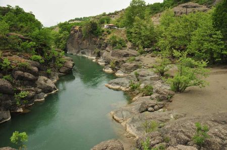
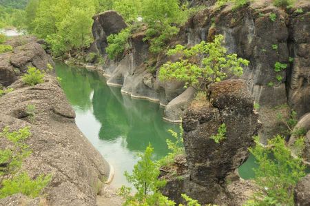
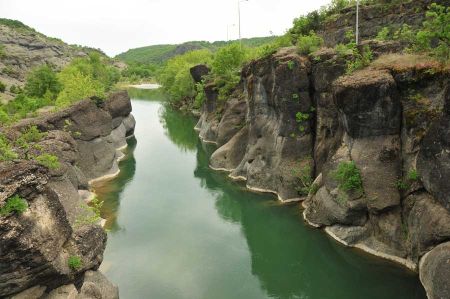
The Venetikos river at the conglomerate gorge at Grevena
- Written by Portal Editor
Once again on the way in the direction of Meteora, we choose the highway 15, which branches off from the highway at Grevena in the direction of Kalambaka and crosses the Venetikos River on an old metal bridge construction.
The Venetikos is a not that much well-known river in the north of the Greek mainland, which rises into the up to 2200 meters high Pindus Mountains. However, most of the water it receives from its right tributary, the Mileapotamos. The river flows through a beautiful, low gorge of black conglomerate, which are of particular beauty at the bridge. So it is not surprising that a parking lot in front of the bridge invites passing travelers to a small stop, which we used again and again too.
The Venetikos - also a destination for canoe and kayak hikers
 Until about the end of May, the Venetikos is also often used by canoeing hikers due to its water level, which find good interim entrance to the river here at the bridge at the road leading from Grevena to Kalambaka. Of course, there are alternative entry points to the river, depending on how far you want to explore the river, as the Venetikos flows through a wonderful, dark conglomerate gorge whose rocks form remarkable shapes. Deep calm pools alternate with slightly blocked floods, at first glance, the passage between the big blocks is not always the same, luckily it looks wilder than it really is! A few small play areas offer variety on this scenic river, towards the end of the season sometimes big stones are blocking. Before the mouth in the Aliakmonas the valley narrows again. Just before the confluence, on the left bank, there is a perfect camp, which also serves as an exit. The trip can be continued on the Aliakmonas for example to the river entrance Felli. The access there is, however, especially in rain only possible for all-terrain vehicles.
Entry point at the bridge of Eleftherochori
 The usual site at the bridge north of Eleftherochori is quickly reached via the village of Kalochi. Here it is used above the bridge on the left bank. To avoid missing parts of the gorge, the kayak / canoes should be carried a little further up the river over a wide gravel bank. So you have taken a small splash and the entrance to the gorge.
The river partly runs through low and black conglomerate gullies, partly also between gravel banks. On the vertical rock walls baffles partly arise. Large boulders in the water are isolated. On short sections you will find pure flow paths on the Venetikos.
Entry point at Eleftherochori N 40° 03' 05'', E 21° 28' 50''
The wild water difficulties are small with WW II and most Greece paddlers usually go for something more difficult. Nevertheless, the Venetikos on the section described here is a scenically not uninteresting river.
The exit point at the mouth of the Venetikos in the Aliakmon
The exit point for sporty hikers and beginners in whitewater sports is located just before the mouth of the Venetikos in the broad Aliakmon. Here, on the left bank, are located two places of sandy and shallow pebble banks. The exit point is reached via a small path that leads south to the Venetikos on the western bank of the bridge over the Aliakmon, southwest of the village of Agapi. Above the exit there is also a very nice and recommendable tent stand with two drinking water wells, a generous parking for campers, places for campfires and a magnificent view of the river.
The exit point at the village of Agapi N 40° 03' 11'', E 21° 33' 32''
Please read as well:
Kato Gazea on Pelion - fishing village between olive groves
Oak moss and moose weed - strange plants on Jablanica
-
 Venetikos River on the way to Meteora
Venetikos River on the way to Meteora
Venetikos River on the way to Meteora
-
 Venetikos River on the way to Meteora
Venetikos River on the way to Meteora
Venetikos River on the way to Meteora
-
 Venetikos River on the way to Meteora
Venetikos River on the way to Meteora
Venetikos River on the way to Meteora
-
 Venetikos River on the way to Meteora
Venetikos River on the way to Meteora
Venetikos River on the way to Meteora
-
 Venetikos River on the way to Meteora
Venetikos River on the way to Meteora
Venetikos River on the way to Meteora
-
 Venetikos River on the way to Meteora
Venetikos River on the way to Meteora
Venetikos River on the way to Meteora
-
 Venetikos River on the way to Meteora
Venetikos River on the way to Meteora
Venetikos River on the way to Meteora
-
 Venetikos River on the way to Meteora
Venetikos River on the way to Meteora
Venetikos River on the way to Meteora
-
 Venetikos River on the way to Meteora
Venetikos River on the way to Meteora
Venetikos River on the way to Meteora
https://www.alaturka.info/en/greece/trikala/4461-the-venetikos-river-at-the-conglomerate-gorge-at-grevena#sigProIdc437d6c188

