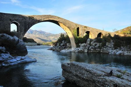
The Ottoman bridge Ura e Mesit at Shkodra
- Written by Portal Editor
It was early afternoon when we talked with the operators of the Legjenda campsite about the Ottoman bridge Ura e Mesit, which ended spontaneously in the approach to the bridge.
Only about 8 kilometers from the campsite you will find this imposing bridge building, probably dating back to the 18th century. The Bridge of Mes, as the translation from the Albanian "Ura e Mesit" would be, crosses the river Kir, which here arrives from the mountains to the coastal plain around Shkodra. Its length is the most important and as well it is best preserved bridge of Ottoman architecture in Albania.
Bridge was part of a trade route
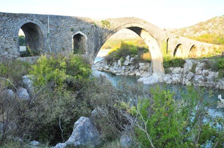 The Ura e Mesit is together with the banks about 108 meters long and consists of 15 arches. Its width is about 3.4 meters. The middle arch is up to 18 meters high. Its width is stated differently by twelve and twenty-one meters, or 21.5 meters, the latter value more likely to correspond to the proportions of the bridge and the height of the arch.
About five meters to the north of the main arch, the bridge is slightly bent. Three arches to the left and right of the main arch are not typical curves, but rather to be described as pointed windows in the masonry. Typical architecture in the Ottoman architecture, which was already noticeable at the Seljuk bridge at Aspendos.
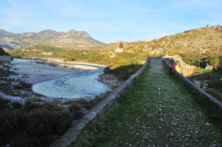 This bridge, too, was part of a trade route that led from Shkodra along the southern edge of the Albanian Alps to Kosovo, a path already used by the Romans, which was still practiced with donkeys until 1944. The bridge also connected Shkodra with the mediaeval town of Drivastum (Albanian Drisht), on the other side of the river.
Because of its similarity with other buildings, it is assumed that the bridge was built at the end of the 18th century by the Shkodranian Pasha Mehmed Bushati, who then had repaired several roads in the area. At that time the cities of northern Albania and West Kosovo were doing well, which allowed the construction of such a "monumental bridge". It could also be that Bushati only had renewed an older bridge from the 17th century or even a Venetian building from the 15th century, or that an older, steeper bridge on both sides type of ramps were extended.
Bike tour from the campsite
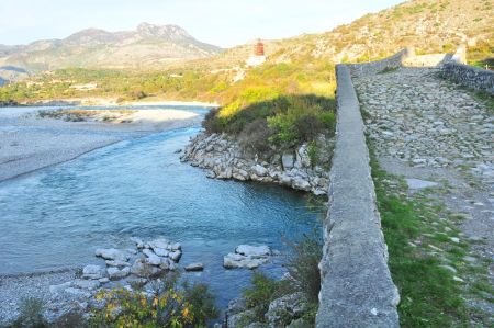 Its name the bridge has got from the small village Mes on the south bank of the Kir. A concrete bridge about 50 meters south and an industrial route slightly further up the valley greatly affect the view of the cultural monument, but ok. In the once communist Albania, Ura e Mesit was a popular tourist destination, which is why, at its eastern end, a cafe was built which has now decayed. In 2010 the access to the bridge, especially on the western site, was renewed - which, like many Albanian river banks, was more like a garbage dump, has since been a well-maintained complex with information boards. In the village on the west bank, there are now also several private cafes, which offers subsequent coffee breaks at the end of a bike tour from the campsite as a day destination.
However, we continued our short trip a bit further and drove along the river Kir deeper into the Albanian Alps, always following the course of the river. Further up we were pointed at a bathing place, which is used by many local people, when it gets too hot in summer in Shkodra. Also a day trip for touring cyclists, especially as the road is asphalted really proper.
Ura e Mesit Ottoman Bridge near Shkodra
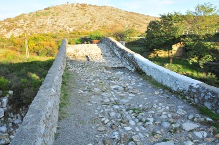 The Ura e Mesit, also known as the "Bridge in the Middle", is an impressive example of Ottoman architecture located about 8 kilometres northeast of the Albanian city of Shkodra. Spanning the Kir River, this historic stone bridge is one of Albania's most important cultural landmarks and attracts numerous tourists and history buffs every year.
History of the Ura e Mesit
The Ura e Mesit was built in the 18th century during the Ottoman rule of Albania. Its construction is believed to have been commissioned by the Bushati family, an influential dynasty in Shkodra. The bridge served as an important link between the trade routes that connected Shkodra with the northern regions of Albania and Montenegro.
The bridge was built using local limestone, which is known for its durability. Despite its age and numerous floods, the Ura e Mesit is remarkably well preserved and is now a listed monument.
Architectural features
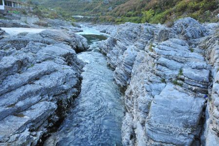 The Ura e Mesit is a masterpiece of Ottoman engineering. With a total length of 108 meters and a width of 3.4 meters, it impresses with its 13 arches, the largest of which has a span of 22 meters. The arches are arranged in harmonious symmetry, giving the bridge an elegant appearance.
Another notable feature is the slope of the bridge, which rises at both ends and reaches its highest point in the middle. This construction served to protect the bridge from floods and to facilitate transport across the river.
The Ura e Mesit today
The Ura e Mesit is not only an architectural monument, but also a popular destination for locals and tourists. It offers picturesque views of the surrounding landscape, which is characterized by green hills, the clear waters of the Kir River and the mountains in the background.
Thanks to its proximity to the city of Shkodra, the bridge is easily accessible and an ideal place for a day trip. Visitors can cross the bridge, explore the surrounding area and enjoy the tranquillity of nature.
Tips for visitors
- Getting there: The Ura e Mesit is easily accessible by car or bicycle from Shkodra. A well-maintained road leads directly to the bridge.
- Best time to visit: Spring and autumn are ideal to experience the bridge and the surrounding nature in its full glory.
- Photography: The combination of historical structure and natural beauty makes the Ura e Mesit a perfect place for photographers.
- Cultural significance: Take the opportunity to learn more about the history and significance of the bridge in the context of Ottoman rule in Albania.
The significance of the Ura e Mesit to Albania
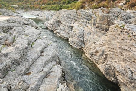 The Ura e Mesit is more than just a bridge – it is a symbol of the connection between the past and the present. It is a reminder of the time when Albania was an important hub in the Ottoman Empire and is a testament to the craftsmanship and architectural skills of that era.
Today, the bridge is an important part of Albania's cultural heritage and a living testimony to Ottoman history in the region.
Conclusion
The Ura e Mesit is a unique example of Ottoman architecture and a must-see destination for anyone visiting Albania. Its historical significance, combined with the stunning scenery, makes it an unforgettable experience.
When in Shkodra, be sure to take the opportunity to visit this impressive structure and immerse yourself in Albania's rich history.
Please read as well:
Wellcome to Camping Legjenda at Shkodra - Albania
Ljubljana - first impression and historical background
-
 Ottoman Bridge next to Shkodra - Albania
Ottoman Bridge next to Shkodra - Albania
Ottoman Bridge next to Shkodra - Albania
-
 Ottoman Bridge next to Shkodra - Albania
Ottoman Bridge next to Shkodra - Albania
Ottoman Bridge next to Shkodra - Albania
-
 Ottoman Bridge next to Shkodra - Albania
Ottoman Bridge next to Shkodra - Albania
Ottoman Bridge next to Shkodra - Albania
-
 Ottoman Bridge next to Shkodra - Albania
Ottoman Bridge next to Shkodra - Albania
Ottoman Bridge next to Shkodra - Albania
-
 Ottoman Bridge next to Shkodra - Albania
Ottoman Bridge next to Shkodra - Albania
Ottoman Bridge next to Shkodra - Albania
-
 Ottoman Bridge next to Shkodra - Albania
Ottoman Bridge next to Shkodra - Albania
Ottoman Bridge next to Shkodra - Albania
-
 Ottoman Bridge next to Shkodra - Albania
Ottoman Bridge next to Shkodra - Albania
Ottoman Bridge next to Shkodra - Albania
-
 Ottoman Bridge next to Shkodra - Albania
Ottoman Bridge next to Shkodra - Albania
Ottoman Bridge next to Shkodra - Albania
-
 Ottoman Bridge next to Shkodra - Albania
Ottoman Bridge next to Shkodra - Albania
Ottoman Bridge next to Shkodra - Albania
-
 Ottoman Bridge next to Shkodra - Albania
Ottoman Bridge next to Shkodra - Albania
Ottoman Bridge next to Shkodra - Albania
-
 Ottoman Bridge next to Shkodra - Albania
Ottoman Bridge next to Shkodra - Albania
Ottoman Bridge next to Shkodra - Albania
-
 Ottoman Bridge next to Shkodra - Albania
Ottoman Bridge next to Shkodra - Albania
Ottoman Bridge next to Shkodra - Albania
-
 Ottoman Bridge next to Shkodra - Albania
Ottoman Bridge next to Shkodra - Albania
Ottoman Bridge next to Shkodra - Albania
-
 Ottoman Bridge next to Shkodra - Albania
Ottoman Bridge next to Shkodra - Albania
Ottoman Bridge next to Shkodra - Albania
-
 Ottoman Bridge next to Shkodra - Albania
Ottoman Bridge next to Shkodra - Albania
Ottoman Bridge next to Shkodra - Albania
-
 Ottoman Bridge next to Shkodra - Albania
Ottoman Bridge next to Shkodra - Albania
Ottoman Bridge next to Shkodra - Albania
-
 Ottoman Bridge next to Shkodra - Albania
Ottoman Bridge next to Shkodra - Albania
Ottoman Bridge next to Shkodra - Albania
-
 Ottoman Bridge next to Shkodra - Albania
Ottoman Bridge next to Shkodra - Albania
Ottoman Bridge next to Shkodra - Albania
https://www.alaturka.info/en/albania/shkoder/3513-the-ottoman-bridge-ura-e-mesit-at-shkodra#sigProIdd0b5483628
