Minsener Oog - Pricken paths through the Wadden Sea
- Written by Portal Editor

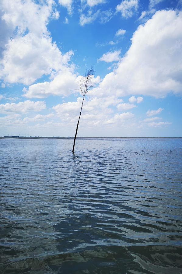
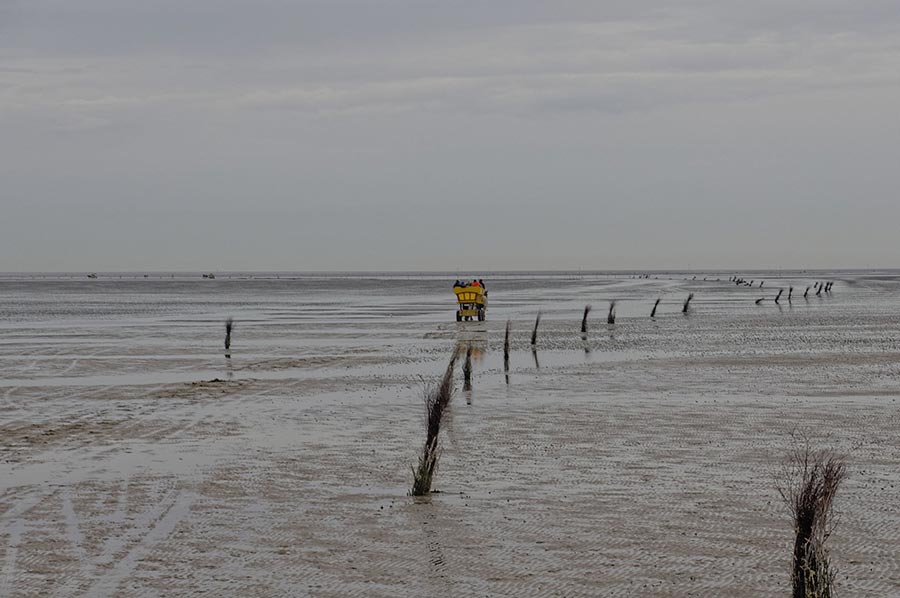
Minsener Oog - Once again, we had to cross the fairway off Minsener Oog, which is shallow at low tide and is marked by distinctive thin tree trunks, usually young birch trees.
If you grew up on the coast, you will of course know this marking of special waterways by its correct name, Pricken or Prigge, depending on which coastal area you are in. We are on the way to Minsener Oog and here off the Frisian coast people say Pricken, which mark the fairway that is shallow here at low tide.
Minsener Oog - Fairway marking in the Wadden Sea
 On the way from Horumersiel, Hooksiel or even Wilhelmshaven to Wangerooge there is a fairway channel marked with Pricken, which shortens the route considerably, so that you do not have to sail around the bird sanctuary island of Minsener Oog. At low tide, this channel can be used by boats with a very shallow draft (max. 60 centimetres), such as flat-bottomed boats, and at high tide, even those with a deeper draft (see nautical charts). In the past, boatmen often ran aground here if they had a suitable boat to do so. Running aground in the Wadden Sea was a unique experience because you:
- experience the changing tides up close.
- can walk on the seabed of the Wadden Sea.
- can perhaps watch seals or whales.
- can enjoy the mudflats undisturbed with your own boat.
Flat-bottomed boats, sailing boats with bilge keels or multihulls can run aground without any technical problems. Boats that only have one keel require mudflat supports, which are usually attached to the side of the boat amidships with a bolt and held vertically by a rope stretched forward and aft. But be careful:
 The new regulation, a revision of the previous navigation rules from 1992, comes into force on April 28, 2023. Since then, many national park laws and protection zones have changed, so that an amendment was necessary. Especially around Minsener Oog. In the summer of 2021, a draft bill was published, which was followed by many objections and criticism from clubs and associations. Apparently little attention was paid to these, because with the amendment, running aground is now prohibited in the entire area with very few exceptions. Many of those affected hoped in vain until the very end for the so-called "corridor solution" - running aground along the fairways.
Furthermore, it is prohibited to
1. run aground with watercraft in the general protection areas or in the special protection areas or
2. sail in special protection areas outside the fairways during the respective protection periods for seals, birds or seagrass meadows
(Excerpt from the Federal Law Gazette)
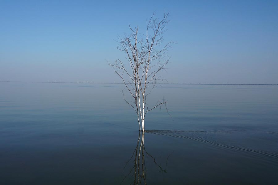
 But now back to the buoys. To mark such secondary channels, buoys that are usually around five to seven meters high are used. These buoys or poles mark narrow and shallow fairways in which buoying with barrels or buoys is too expensive or not possible due to the water being too shallow. In contrast to normal buoying, usually only one side of the fairway is marked.
It is important for the sailor that buoys mark a fairway as follows:
Port side of the fairway: birch trees or poles stuck into the ground, with branches tied together at the top (blunt shape), the poles usually have a small red reflective ribbon (colloquially known as "birch trees" or "brooms").
 Starboard side of the fairway: poles stuck into the ground, to the upper end of which branches tied together at the top and bent apart at the bottom have been attached (pointed shape), they usually have a small green reflector ribbon (colloquially called "fir trees").
The use of the pegs (port/starboard) follows the direction of the buoys, see fairway designation of the fairway, and can be found on the nautical charts.
On the North Sea coast, port pegs are predominantly used because the branches do not need to be worked on additionally. A fairway with port poles is often known in the local dialect as a broom road because it looks like upside-down brooms. Pegs must be passed at a distance of around three to five meters. Pegs usually do not survive the storms and ice drifts of winter and must be re-set every year. Nowadays, so-called peg-setting boats are used to set the pegs.
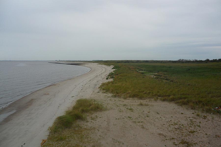
Marking the mudflat hiking trails with pegs along Minsener Oog
 To mark mudflat hiking trails, bush pegs or bush beacons are dug into the mudflats without poles. These approximately 1 m high path markers are at great risk from ice drifts. In addition, the tidal channels move a few meters every year, so that even experienced mudflat guides have to constantly reorient themselves. That is why the bush pricks are usually re-laid in the spring. This type of path marking is quite common on the coast, or rather in the Wadden Sea in Schleswig-Holstein, but rather rare in Friesland or East Frisia, so the mudflat hiking trail to Minsener Oog is not marked and should only be used as part of a guided tour by a mudflat guide.
Please also read: