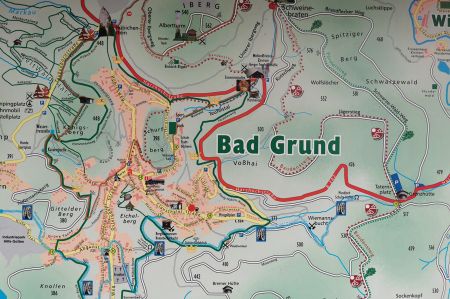
Hiking Bad Grund – From Albert Tower to World Forest
- Written by Portal Editor
A next Harz hiking destination was quickly found with the so-called World Forest, as well as other destinations in the Bad Grund area, so we also had the Albert Tower, the Hübichenstein and the quarry of the limestone mining area in mind.
We have already reported on the Hübichenstein and the World Forest, so it should now mainly be about our hike with the goal of the two hiking stamps 129 and 130. As you can see, collecting the stamps for the Harz Hiking Pin motivates us too. So first to the Albert Tower, which lies above the Iberg stalactite cave.
Albert Tower with the option of self-sufficiency based on trust
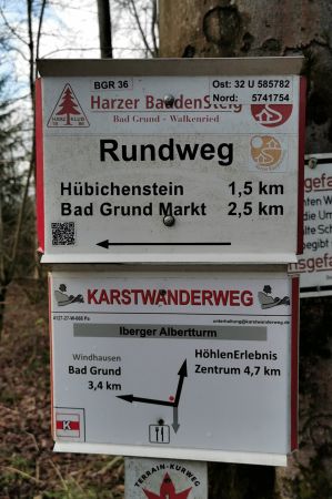 The starting and ending point of today's hike is the large car park at the Iberg stalactite cave, which we leave in the direction of "roast pork" on the Kutschweg, which climbs steadily and quite steeply. A forest path also leads up in the direction of Schweinebraten, which, however, is currently difficult to walk on due to the wetness. The so-called "roast pork" is an important crossroads on the eastern slope of the Iberg in the forest north of Bad Grund. From here, paths run in a star shape in all directions, including the Harzer Försterstieg. Such an intersection of many hiking trails is of course also a good place to rest, maybe that's where the name comes from? During such a short break, you can calmly think about the further course of the hiking route if necessary. However, our goal today is the Albert Tower, so keep going.
 The Albert Tower, which is around 34 meters high, stands on a mountain spur of the Iberg at around 555 meters above sea level and is also the stamp of the Harz hiking pin number 130. It is therefore a popular hiking destination and at the same time offers a beautiful view of the surrounding Harz mountains and the near the western foreland of this mountain range. A first observation tower was built at this location in 1886 on the initiative of various clubs from Bad Grund. However, this approx. 20-meter high wooden construction was not up to the harsh weather conditions of the Harz Mountains and had to be demolished after a relatively short period of use due to considerable damage. In August 1907 the construction of a new lookout tower began on the site of the previous building. This stone building, now 25 meters high, was inaugurated in May 1908. The new tower was named "Albertturm" in honor of the founding member of the Harz Club, Albert Schneider.
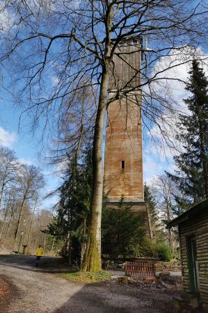 The surrounding beech forest had grown very high over the decades and a good view was no longer possible from the Albert Tower. Therefore, in 1963, the tower was raised by almost 10 meters to its current height. Since then, you have had a good view of large parts of the western Harz Mountains and the western Harz Foreland. Admission is 50 cents.
Next to the Albert Tower there is a forest restaurant with a café that is unfortunately probably permanently closed. However, there is the possibility of self-service with drinks and small snacks, which each guest can purchase. The corresponding amount of money is to be paid in confidence and without control into a vessel. It's nice to see that something like this still exists today - trust on the one hand and honesty on the other!
Near the Albert Tower on the way to the Hübichenstein we first come across huge fields of wild garlic, which arouse our interest, then the so-called "glacier pots" - several of these impressive rock depressions can be viewed from a safe position behind the barriers, but let's continue, now to the view of the huge limestone quarry, whose hammering can still be heard far away today. Impressive and yet frightening at the same time how such a huge hole could be created in the rocks. Human greed is immeasurable – and overexploitation of nature at that. What will it look like here a hundred years later?
Hübichenstein by the wayside and the search for stamp 129
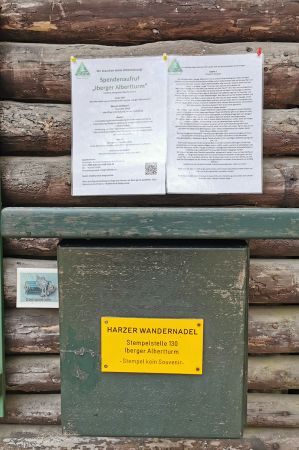 We use the Baudensteig circular route to descend in the direction of Hübichenstein, which we have already described in our article "Encountering the Hübichenstein near Bad Grund". According to the coordinates we have, stamping point 129 should be located a little further up the path. Our search at this point - unfortunately in vain. A first encounter describes the possible new location so imprecisely that this search is also in vain and a short time later we are back at the probably previous location of the stamp office.
This time we meet a group of hikers who can give us some details on how to find the stamp office, but even so we can extend our hike today, but not yet to the stamp office. As we found out later, it would have been very easy and up to about 100 meters it was our turn. As a hint and tip: The stamp office is in the WeltWald at the refuge and we have now adjusted the Google location with the corresponding coordinates.
Through the fairy tale valley to the Eisenstein tunnel
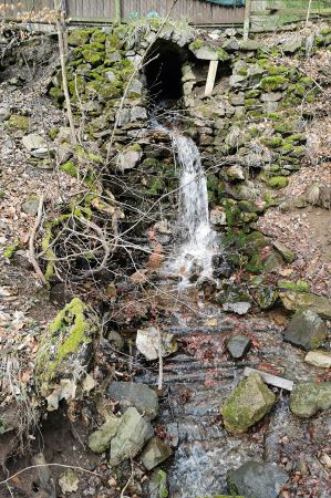
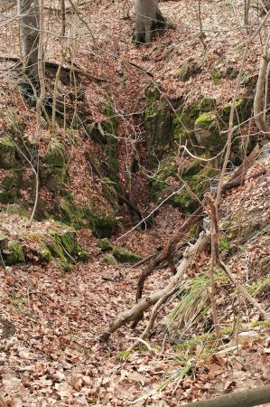 We return to the starting point below the country road on a hiking trail to the Iberg stalactite cave, then across a courtyard down into the fairy tale valley, where almost at the end of our hike we come across the iron stone tunnel, which has unfortunately already been closed again.
The name Eisensteinstollen goes back to the fact that the cave was "excavated" in the last century to extract iron ore. Even then it was said that it was good for an "attacked" respiratory system to stay in the tunnel. Very special, natural physical conditions ensure that any contamination of the cave atmosphere with pollen, soot and other dust particles from the outside is prevented. The air currents, finely filtered through the labyrinth of caves, are saturated with moisture from dripping water inside the mountain to almost 100%.
 The high-water content helps keep the air in the cave constantly clean by immediately absorbing and transporting away particles that may have been brought in from outside. In addition, the moisture ensures the constant formation of therapeutically effective natural aerosols (tiny mist droplets), which have a beneficial antispasmodic effect.
One of the special features of the Eisenstein tunnel is the almost constant temperature. In both summer and winter, the mercury column of the thermometer only fluctuates between +7 and +9 degrees C. This accelerates the condensation processes of particles that may have a higher temperature.
Please read as well:
Harzer hiking needles - one system prevails!
Struga - shoeshine and bridge jumper at the Black Drin
-
 Hiking Harz Mountains at Bad Grund
Hiking Harz Mountains at Bad Grund
Hiking Harz Mountains at Bad Grund
-
 Hiking Harz Mountains at Bad Grund
Hiking Harz Mountains at Bad Grund
Hiking Harz Mountains at Bad Grund
-
 Hiking Harz Mountains at Bad Grund
Hiking Harz Mountains at Bad Grund
Hiking Harz Mountains at Bad Grund
-
 Hiking Harz Mountains at Bad Grund
Hiking Harz Mountains at Bad Grund
Hiking Harz Mountains at Bad Grund
-
 Hiking Harz Mountains at Bad Grund
Hiking Harz Mountains at Bad Grund
Hiking Harz Mountains at Bad Grund
-
 Hiking Harz Mountains at Bad Grund
Hiking Harz Mountains at Bad Grund
Hiking Harz Mountains at Bad Grund
-
 Hiking Harz Mountains at Bad Grund
Hiking Harz Mountains at Bad Grund
Hiking Harz Mountains at Bad Grund
-
 Hiking Harz Mountains at Bad Grund
Hiking Harz Mountains at Bad Grund
Hiking Harz Mountains at Bad Grund
-
 Hiking Harz Mountains at Bad Grund
Hiking Harz Mountains at Bad Grund
Hiking Harz Mountains at Bad Grund
-
 Hiking Harz Mountains at Bad Grund
Hiking Harz Mountains at Bad Grund
Hiking Harz Mountains at Bad Grund
-
 Hiking Harz Mountains at Bad Grund
Hiking Harz Mountains at Bad Grund
Hiking Harz Mountains at Bad Grund
-
 Hiking Harz Mountains at Bad Grund
Hiking Harz Mountains at Bad Grund
Hiking Harz Mountains at Bad Grund
-
 Hiking Harz Mountains at Bad Grund
Hiking Harz Mountains at Bad Grund
Hiking Harz Mountains at Bad Grund
-
 Hiking Harz Mountains at Bad Grund
Hiking Harz Mountains at Bad Grund
Hiking Harz Mountains at Bad Grund
-
 Hiking Harz Mountains at Bad Grund
Hiking Harz Mountains at Bad Grund
Hiking Harz Mountains at Bad Grund
https://www.alaturka.info/en/hiking-tours/6053-hiking-bad-grund-from-albert-tower-to-world-forest#sigProId1b582f4ea3
