Stamping points take us to the Devil's Wall in the Harz
- Written by Portal Editor

Once we were gripped by the fever of collecting stamps to receive the Harz hiking badge, this was simultaneously linked to research and subsequently visiting other highlights in the Harz.
So really effective Harz marketing, if you will. But of course, also extremely interesting. If you haven't received any information about the Harz hiking badge yet, please follow this link. We had already hiked or cycled to a few destinations to receive the Harz hiking badge, so during our preliminary research between Neinstedt and Weddersleben we came across stamping point 188 and the two stamping points 74 near Timmersrode at the Hamburger Wappen and near Blankenburg below the Vaterpfalz at the Vaterpfalz inn with the number 76, or rather parts of the so-called Devil's Wall.
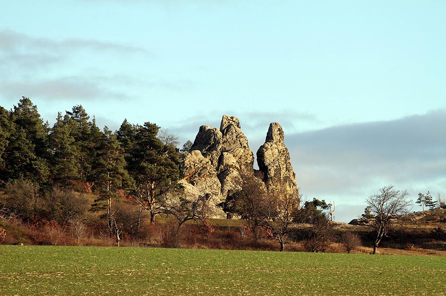
Sandstone from the Cretaceous period formed the impressive rock formations
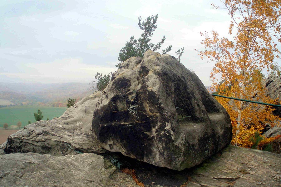 From an earthly perspective, the rocky cliffs of the Devil's Wall were formed by hard sandstones from various eras of the Upper Cretaceous period.
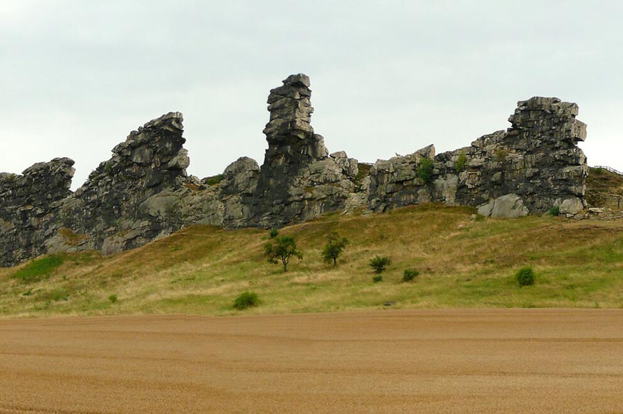
Like all layers on the northern edge of the Harz, the rock layers were steeply positioned or even tipped over by the uplift of the Harz that continued until the Cretaceous period, so that the former layer surfaces now face downwards.
A gap in the layers between the Lias and the Lower Cretaceous and the deposits of the Upper Cretaceous that extend to the Muschelkalk are evidence of activities at different times, which took place primarily on the northern edge of the Harz fault.
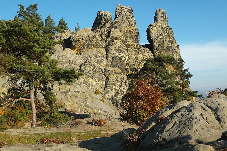
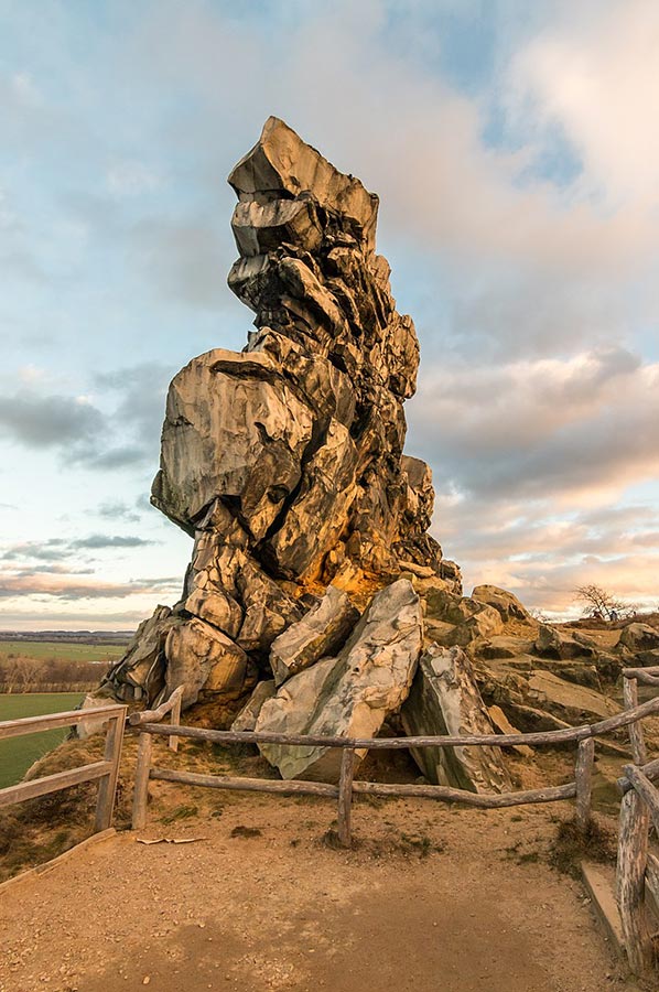 The subsequent erosion of the softer rock sections turned the hard rock layers into distinctive layer ribs that tower over their surroundings with cliffs up to 20 m high.
Some parts were destroyed by the action of the rivers and later by ice age glaciers. This is why the Devil's Wall has various gaps today. A different course of the Bode is mainly responsible for this.
Archaeological evidence shows traces of the Paleolithic period, the Linear Pottery culture period and the Bronze Age. The first settlers were already present at the Devil's Wall during the Stone Age, as several Stone Age quartzite tools, such as core stones, flakes and a hand axe, were recovered.
 Karl Schirwitz pointed out that the cliffs were used in historical times to extract quarry stone and paving stone, "whereby handy flakes, including blade-shaped ones, can be obtained easily and in large numbers." He clearly classifies the roughly chipped large shapes of the middle stones as belonging to the Stone Age.
As early as 1922, Adolf Brinkmann established the former existence of a settlement: "The Devil's Wall, which slopes steeply to the northeast, appears on its southern side to be a prehistoric rampart, on which the depression of the former huts can still be seen."
However, he leaves open the period from which this rampart might date.
 In the period before 1931, a Bronze Age hoard was recovered and brought to the museum in Quedlinburg. There are several Bohemian heel axes that are dated to the Bronze Age.
Another settlement was located in 1980 in the area of the eastern part of the Königsstein. Several shards and stone tools from the younger Linear Pottery culture were recovered here as finds.
Johann Wolfgang von Goethe, fascinated by geology, visited the legendary sandstone wall in 1784. The Goethe Stone, erected in 2005, commemorates this.
Hiking trails, legends and myths about the Devil's Wall
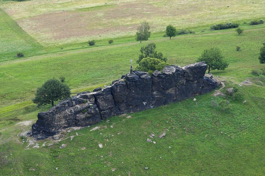
 Many legends and myths have been created to explain the special nature of this place. It was therefore placed under protection by the district administrator in 1833 and 1852 in order to prevent the mining of the sought-after building sandstone.
The Devil's Wall near Weddersleben has been designated as the Devil's Wall and Bode nature reserve northeast of Thale since 1935 and is therefore one of the oldest nature reserves in Germany.
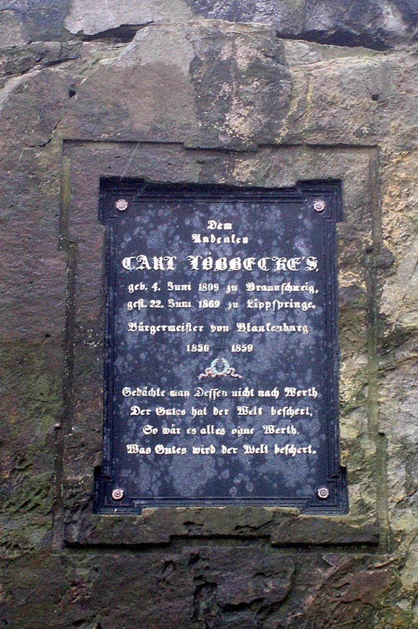
 The rock bands of the Teufelsmauer are accessible via hiking trails. They are one of the attractions of the towns of Thale and Blankenburg. The ridge path from the Hamburg coat of arms to the grandfather rock was built in 1853 by the mayor of Blankenburg, Carl Löbbecke, in whose memory a cast-iron memorial plaque was erected on the Löbbecke rock; this section of the path is also known as the Löbbeckestieg. The Timmenrode–Blankenburg section of the European long-distance hiking trail E11 runs along the rock formation.
 To protect protected plant species, measures to direct visitors have become necessary in the Teufelsmauer nature reserve. The rock areas can be experienced from the hiking trails, which are secured with barriers in many places. The Teufelsmauerstieg runs along all the rock elevations of the Teufelsmauer between Ballenstedt and Blankenburg and was inaugurated as a 35 km long hiking trail in August 2009.
Several of the rocks of the Teufelsmauer near Blankenburg are open to climbing.
One of the legends about the Devil's Wall: About the devil and the rooster
 The first version of the legend has a market woman and a rooster coming from Cattenstedt, a small village near Blankenburg: "God and the devil argued about ownership of the earth; they agreed that God should keep the fertile plains and the devil should get the ore-rich Harz Mountains if he had finished a border wall by the first rooster crow. He built it up to the edge of the Harz. When one stone was still missing, the rooster crowed, which a market woman from Cattenstedt, who was on her way to Blankenburg, had in her basket. The work was in vain and the devil angrily destroyed his work."
Please read as well:
Hiking trail "Huttaler Wider Waage" - stamps 127 & 128