Roman Technique - Finding East-West Direction in Landscape
- Written by Portal Editor
For us modern people, many technical facilities have become so natural that we use them without thinking and never even think of asking ourselves how these things were done in the past.
If we want to drive from point A to point B today, we get in the car, switch on the navigation device, enter the address data and thanks to GPS we can be on our way. Who of us still uses a compass today when he wants to go west or east. Who orients himself to the celestial stars when he wants to travel towards sunrise?
Amazingly, the Roman architects and builders knew exactly how to align a street, an army camp or even a city, even without a GPS and without a compass. How was that possible? Even more, despite the excellent construction technology, nobody really thought about basic mathematical, geometric, static problems, because the Romans were never people of arithmetic geniuses.
Nevertheless, they built a road system of more than 85,000 kilometers, some of which were paved and constructed in such a way that they are still used today with their bridges and pass crossings. How could they align their army camps exactly in an east-west direction and even plan and build new cities in such a way that exact grid systems were created?
Romans used the position of the sun
 The answer to this question is relatively simple: They combined natural events or findings with practical little auxiliary tools and used these devices for their own purposes. If you want to determine the course of a street from east to west, you can orientate yourself on the position of the sun. So the Romans used this knowledge to develop such an amazingly simple instrument that shows exactly the east-west course, without a compass or GPS.
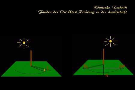
A shadow receiver in the form of a pen is inserted onto a rectangular, flat surface made of wood or metal, which is also the center of a partial circle. Neither the size of the plate nor the length of the pen plays such an important role because you just have to make sure that the shadow of the pen remains on the plate during the lowest position of the sun. Due to the change in the position of the sun over the course of the day, the pen's shadow will be longest in the morning and evening, while it will be shortest at noon. At some point during the day, the tip of the shadow will be exactly on our recorded partial circle. Since this will happen twice a day, once in the morning and once in the afternoon, we get two points on our partial circle. So we just need about time to observe the course of the shadow and to mark the two points mentioned. Connecting both points with the help of a line results in the exact east-west direction, which can now be transferred to the terrain via fixed points with the help of poles.
Sciotherum - to find east west - direction
 The Romans called this base plate with the shadow taker "sciotherum", the east-west line determined in this way "decumanus". The "surveying engineers" of the Romans who were responsible for this type of surveying mostly belonged to the group of augurs, Roman officials who officially had to fathom whether a planned undertaking was acceptable to the gods. The Augur then officially proclaimed the will of the gods, which he had recognized from the flight and the screams of birds and other animal species.
Please read as well:
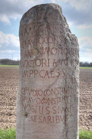
Roman milestones, also called "miliarium"
Stadiasmos Patarensis of Patara - Sahin Sencer
