Our trip across the Zuiderdamm to Callantsoog
- Written by Portal Editor
As already reported in a first blog article, the destination of our trip into the weekend was Callandsoog in North Holland, a small, idyllic coastal town on the North Sea, which has become particularly well known for the height and beauty of its sand dunes and its cycle paths.
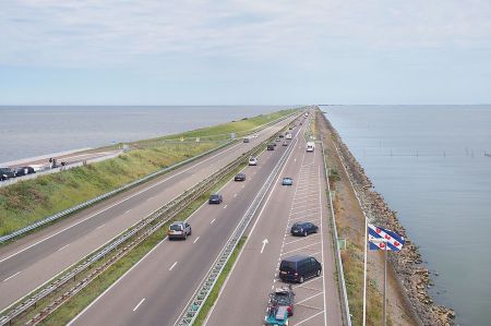
In order to avoid the hustle and bustle on the streets around Amsterdam during the journey, we had chosen to come from Rheine via the Zuiderdamm. At the former connection point of the former Zuiderzee to the Wadden Sea (Waddenzee), a connecting road was created through the construction of the 29-kilometer-long dyke (Afsluitdijk), which is still considered a masterpiece of engineering from 1932.
The dike is 90 meters wide and carries the Dutch Autobahn 7 (European Route 22) and its cycle path on its side facing the IJsselmeer. It was built as part of the Zuiderzee Works, primarily to protect the coast. The elimination of the tides in the IJsselmeer made it easier to embank and drain water areas. This created large polders on the outskirts of the lake, the largest of which are in the province of Flevoland.
Romans already had respect for the marshy areas
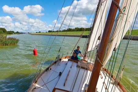 The Romans already knew a large, swampy water landscape in this area, even if the actual lake, called lacus Flevus, was probably much smaller than the later Zuiderzee. The Roman general Drusus had around 12 BC. Build the so-called Drusus Canal (fossa Drusiana) from the Rhine to Lake Flevo in order to shorten the route of the Roman fleets to the North Sea. This sea connection played a major role during the Germanicus campaigns (14 to 16 AD). This lake landscape was probably created in the seventh century BC. Even then, during storm surges, the water penetrated far into the flat and low-lying land, gradually eroding the moor lying behind the dunes as it flowed back. On the other hand, the lake system was increasingly expanded by tributaries of the IJssel (right estuary arm of the Lek, on the German side the Issel on the right Lower Rhine) and other streams and rivers, so that over time a large freshwater flow was formed towards the north. The Flevosee therefore became considerably larger over time and was therefore soon called Almere (Aalsee).
Diking as a solution to large floods
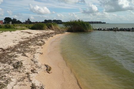
 With the Julian Flood in 1164, the All Saints' Flood of 1170 and finally the floods of 1219 (First Marcellus Flood) and 1228, the salt water broke into the area - the naturally formed sand dike was broken, and the inland water formed a sea bay in the north of the Netherlands . With the removal of the swampy soil of the new sea, the Waddenzee (Wadden Sea) formed on the south side of today's West Frisian Islands in addition to the Zuiderzee. After the annexation of the Kingdom of Holland by Napoleon Bonaparte, there was the Zuyderzée department between 1811 and 1814, which belonged to the French Empire.
 It was not until the construction of the artificial "closing dike" in 1932 that an inland water body was created again. The Zuiderzee actually became the IJsselmeer (“the IJsselsee”) on 28 May 1932 at 1:02 p.m. when the last gate (De Vlieter) of the dike was closed. The official renaming took place on September 20th. As a result, parts of the former Zuiderzee were drained as polders (Zuiderzeewerke), including today's province of Flevoland including the north-east polder (Noordoostpolder) with the former islands of Schokland and Urk. The main initiator of this work was the engineer and politician Cornelis Lely, after whom the Flevoland provincial capital Lelystad is named. The largest city on Flevoland is called Almere and belongs to the catchment area of Amsterdam. Flevoland is now more important as an additional area for this conurbation than as agricultural land for which it was originally intended.
Dike also brought potential danger
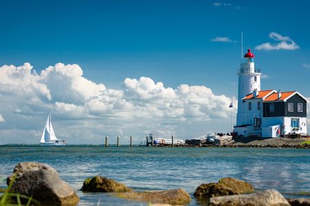 Today's freshwater lake, which was artificially created by dyking in 1932, consists of a large part of the former Zuiderzee bay between Friesland and North Holland. The remaining IJsselmeer between Zuiderdamm and the "mainland" has, apart from a few artificial depressions, between 2 m and 5.5 m water depth. Since 1976 it has been divided by the inland dike (Houtribdijk) into the rest of the IJsselmeer, which covers an area of 1137.4 km², and, to the south-west of it, the Markermeer, which covers 700.6 km². Two locks at Enkhuizen and Lelystad connect the water areas. The Markermeer was originally intended to be drained as the Markerwaard polder. Because there was hardly any need for new land, construction was postponed indefinitely in 1991.
As early as the construction of the dyke to the North Sea, the Dutch generals recognized the military danger that threatened Fortress Holland with this new approach from the north. The response was to build the Den Oever and Kornwerderzand forts at both ends of the dyke. In May 1940, during the attack in World War II, the attacking German Wehrmacht could not gain access to Fortress Holland at this point.
The name Zuiderzee can still be found on historical maps and documents up to the early 20th century and is now only used in a historical context.
Please also read:
