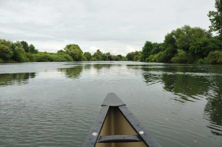
Main River - a border river of the Roman Empire too
- Written by Portal Editor
For a few days we have been on the move as part of our project on the Main, which must also be regarded as an external border or Limes on the western side of the Roman Empire, at least for sections of it.
With a flow length of around 530 kilometres, the Main is one of the longest tributaries of the Rhine. If you only look at the rivers to the right of the Rhine, the Main is actually the longest tributary. The two source rivers of the Main, the White Main rises in the Fichtelgebirge, the Red Main rises in the Franconian Jura, unite in Kulmbach to form the Main. Striking changes of direction in the course of the river due to the Franconian Mountain ranges create loops and gentle slopes that are ideal for winegrowing. However, the east-west main flow direction, which is rare for rivers in Central Europe, is always retained. In addition to Franconian wine, there are numerous historic town centres along the Main that invite you to visit and linger.
 The name Main probably originally comes from the Celts, who called the river Moin or Mogin. With the advance of the Romans at the beginning of the 1st century AD and beyond the Main, they Latinized the name to Moenus. The geographer Pomponius Mela, who had also made the first measurements of Lake Constance, provided the first written evidence of the naming Moenus in the years 43 and 44 AD.
In his "Naturalis historia" later Pliny also reports of the Main as Moenus. Interestingly, there are also rivers in Ireland and Britain with almost identical names: Maoin and Meon, Latin maionus. Linguists therefore attribute the naming to the Indo-European word "mei" meaning water (Latvian maina, Lithuanian maiva). Still other scientists see a connection to the words for wall or fence (Latin moenia). In the Middle Ages the name was changed to Moyn, later to Meyn. Even today, the different dialects along the Main give the river different names:
Maa in Upper Franconia,
Mee in eastern Lower Franconia,
Maa (locally partially nasalized, partially muffled) on the Bavarian Lower Main
Moa Wertheim area
Maa (nasalised) in the Frankfurt area.
Outer border of the Romans on the Main
 While the lower reaches of the Main and the area where it flows into the Rhine was already assigned to the Roman Empire as the province of Germania superior (Upper Germany) in the days of Emperor Augustus, part of the outer border ran along the western side of the so-called quadrilateral, a line that can be identified by the present-day cities of Gemünden, Wertheim, Miltenberg and Aschaffenburg.
In this quadrilateral, which is open to the north and contains the above-mentioned corner points of today's cities, the Main formed the Limes (the border) of the Roman Empire, since the Main flows around the southern part of the Spessart for about 100 kilometres.
 This border line was guarded by a series of nine or ten forts, but it was not separated from free Germania by the Limes with a wall or rampart with a palisade including a ditch, which was otherwise common in the Roman Empire. Instead, as on other river borders, the river was sufficient to prevent unwanted approaches. The so-called Main Limes as part of the Upper Germanic Limes ran between today's towns of Großkrotzenburg and Bürgstadt.
According to the knowledge available so far, no legion was stationed in this area. But there was always a Ledion in Mogontiacum, today's Mainz, opposite the confluence of the Main and the Rhine. It was not until excavations in 1985 that a large military camp near Marktbreit could be proven; but it apparently did not serve to subdue this area, because there is no evidence to assume that an eastward expansion was planned from here.
Along the Main square
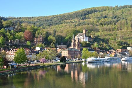 The largest right tributary of the Main, the Franconian Saale, and in Lohr the largest river from the Spessart, the Lohr, flow into the Main from the north-east in Gemünden. From here the Main valley, which runs southwards, becomes narrower, densely wooded and sparsely populated.
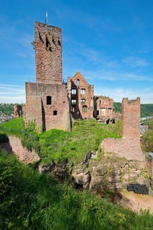
Eight kilometres south of Lohr, on the right-hand side, is Neustadt am Main with a 1,250-year-old former Benedictine monastery that is well worth seeing. The Christianization of East Franconia in the 8th century emanated from him and from Würzburg. A pedestrian bridge connects Neustadt with its district of Erlach, a former shipping settlement. Rothenfels at the foot of the Romanesque castle of the same name is the smallest town in Bavaria with around 1000 inhabitants. Only at the south-eastern corner of the Mainviereck are two small towns again, Marktheidenfeld and Wertheim. Immediately above Wertheim, the Main forms a long loop, the so-called Kingdom of Heaven. There it flows for five kilometres around a spur that runs out to the south and is only 500 m wide at its narrowest point.
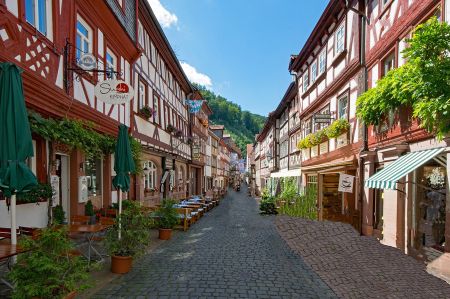 In Wertheim, with its medieval townscape and castle ruins, the Tauber flows into the Main from the south.
From Wertheim, the Main flows west in meanders, separating the states of Baden-Württemberg and Bavaria.
Wertheim on the left bank of the Main was Baden and now belongs to Baden-Württemberg, while the much older Kreuzwertheim on the right side of the Main is Bavarian.
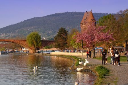 The landscape is now similar to that on the eastern side of the square. In the winding, densely wooded valley that borders the Spessart in the south, lie the two towns of Stadtprozelten and Freudenberg, towered over by castles, as well as the oldest settlement in the area, Dorfprozelten.
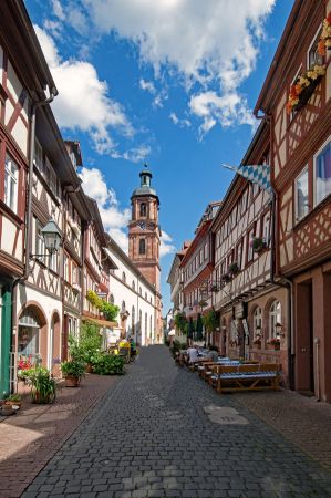
The half-timbered town of Miltenberg at the mouth of the Mud marks the south-west corner of the Mainviereck. Many medieval churches, for example in Frankfurt or Mainz, were built from Miltenberg Buntsandstein, which was shipped from the quarries to the construction sites.
Limes runs north of the Main through swampy areas
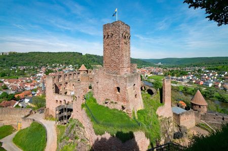 In the north-facing valley between the Odenwald and Spessart lay the Alemannic settlement of Grubingen, which disappeared in the 17th century and whose St. Michaelis church stood on the banks of the Main until 1778. Other small towns with well-preserved town centres follow, such as Klingenberg and Obernburg. The settlement density along the Main is now increasing significantly.
The Rhein-Main conurbation, the second largest German metropolitan region, is reached in Aschaffenburg. The landmark of the former residence of Mainz, the Renaissance castle of Johannisburg, lies to the right of the bank of a Main curve stretching far to the east.
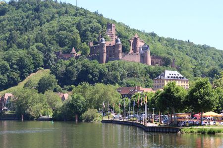 The Main Limes, also known as the Nasser Limes, was established around 90 AD and, as part of the Upper Germanic-Rhaetian Limes, formed the border of the Roman Empire in the area between today's towns of Großkrotzenburg and Bürgstadt. In this section, the Limes meets the Main (Moenus), which formed a natural border for about 50 kilometres.
Individual watchtowers in connection with the forts of the units lying here were sufficient to secure the river bank; a continuous barrier, consisting of palisades and ditch, never existed here. Of the watchtowers suspected to be along the Main, only one south of Obernburg am Main has been proven with certainty. On the other bank of the Main was the Spessart, which was largely uninhabited at the time and, like the Odenwald bordering to the south-west, was economically interesting for the Romans mainly because of its abundance of wood. Inscriptions tell of lumberjack vexillations of the Legio XXII, who were stationed in Stockstadt, Obernburg and Trennfurt.
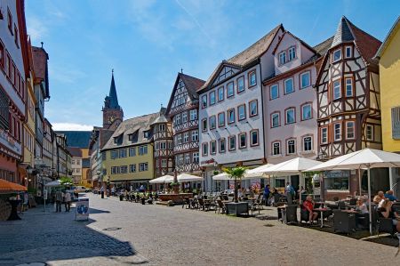 Settlement activity continued in the majority of the forts even after the Limes fell, which is why, as in Obernburg, Niedernberg, Seligenstadt and Großkrotzenburg, they are now located below the medieval town centres. Alemannic finds were also made in Großkrotzenburg, Hainstadt, Stockstadt and Obernburg.
North of the Main, the Limes first runs through the swampy areas of the Schifflache and the Bulau, followed by the Wetterau-Limes. At the Main crossing near Großkrotzenburg, a Roman bridge has been proven by finds of pile shoes. In the early days it extended to Obernburg or Wörth in the south.
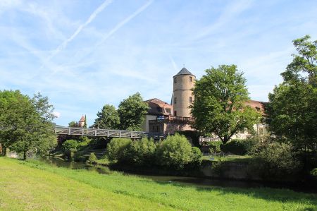 The exact starting point of the Odenwald Limes (Obernburg or Wörth) has not yet been clearly documented. With the abandonment of the Odenwald Limes in the 2nd century AD under Antoninus Pius and the advancement to the younger Limes line in the building land, the Main Limes was also extended, since the forts in Trennfurt and Miltenberg were added (younger Main Limes).
Please read as well:
