The Great Meander and its little "brother"
- Written by Portal Editor
After the Euphrates and Tigris, Seyhan and Ceyhan rivers, the Great Menderes River also belongs to the group of rivers that are extremely important for agriculture and thus for the development of humanity, because when people became sedentary, they were dependent on fertile soil and a constant supply of water.
It is therefore not surprising that large rivers all over the world are particularly important in the development of human civilizations.
The Great Meander flows past Denizli
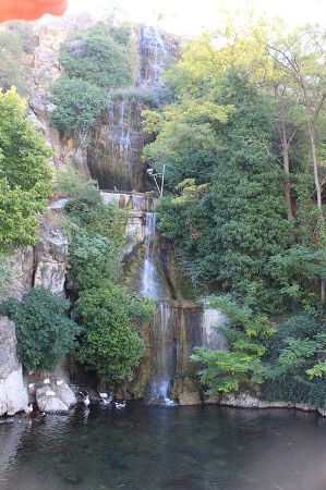 In the mountains of Phrygia, the Great Meander arises almost in the middle between the two provincial capitals of Uşak and Afyon from the confluence of the Banaz and the Kufi, which are considered to be the source rivers of the Menderes. Strabo already mentioned the city of Dinar, although at that time it was called Kelainai, as the source of the Menderes and as an important trading centre during the Hellenistic period. To the west, the Great Menderes flows past Denizli until it flows into the Aegean Sea near the ancient city of Miletus after 550 kilometres. This length makes it the most important river in Western Anatolia with an immense impact on agriculture, particularly because it carries huge amounts of sediment, the content of which is ultimately so important for the cultivation of grain, fruit and vegetables.
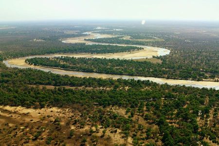
It is particularly important here that the Great Menderes is the actual namesake of the so-called river meanders, a river course that meanders like a snake through a gently sloping plain, leaving deposits of sand and gravel in the bends. Thanks to this and the fact that frequent floods led to the deposition of sediment in the entire floodplain, the sediment deposits have been able to contribute to the wealth of agriculture since time immemorial.
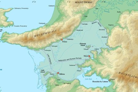
 What was a great stroke of luck for the settlers of the alluvial land next to the river, however, led to the complete silting up of huge areas at the mouth of the Aegean Sea and thus to the loss of really important port cities of the ancient era. When you look at the map attached, you will quickly find the port cities of Miletus and Priene, which were important Hellenistic ports. Today's inland lake Bafa Lake was also just a bay around the turn of the century, which was gradually separated from the sea by silting up until the 4th century. Today located far away from the sea, silting up meant the end of the port cities and the downfall of once flourishing metropolises.
The ancient city of Magnesia, which was also once connected to the sea and lay between Söke and Aydin, shared the same fate. The distances between the places alone make it clear what huge amounts of sediment the Great Menderes has deposited here over time.
Small Meander / Küçük Menderes
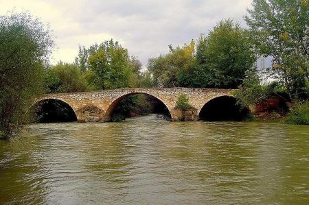 The small Menderes, which was called Kaystros in ancient times and runs almost parallel to the Great Menderes at a distance of about 30 kilometres, had a very similar impact on the development of settlement. The Small Menderes rises east of the Boz Dağı, a 2,159-meter-high mountain massif about halfway between Izmir and Denizli.
After just 200 kilometres, the Small Menderes reaches the Aegean Sea, where the ancient city of Ephesus had its port facilities, which today attract thousands of tourists every year. These port facilities located at the mouth of the river had made Ephesus the largest and most influential city in the province of Asia of the Roman Empire, before this port also silted up due to sediment deposits from the small river.
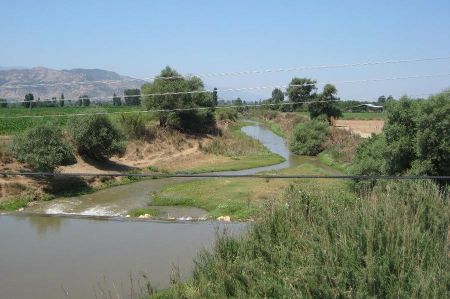 Today you have to drive several kilometres to cross the alluvial land if you want to get to the mouth of the Small Menderes. Here too, the sediments carried along by the meanders or bends led to wealth in agriculture and almost simultaneously to the loss of the port city. The bends of these two rivers ultimately led to the use of the name meander to describe a phenomenon that occurs worldwide.
The ancient Meander River, known today as the Büyük Menderes in Turkey, has long captured the imagination of historians, geographers, and travelers alike. Its winding path through the fertile plains of Anatolia gave rise to the term “meander,” now used worldwide to describe a serpentine river course. But what many don’t know is that the Meander has a lesser-known counterpart, a smaller “brother,” that shares its region and charm. Let’s explore the fascinating tale of these two rivers and their historical and geographical significance.
The Great Meander: A River of History
Origins and Geography
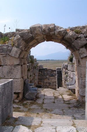 The Meander River originates in the Anatolian highlands near Dinar and flows westward for approximately 584 kilometers before emptying into the Aegean Sea. Its name, derived from the Greek “Maiandros,” reflects its characteristic curves and loops, which were legendary even in ancient times.
Cultural Significance
In antiquity, the Meander River was more than just a geographical feature; it was a lifeline for the cities of Miletus, Priene, and Didyma, which thrived along its banks. These cities were key players in the Ionian League and significant centers of trade, culture, and philosophy.
Symbolism in Literature and Art
The river’s winding path became a metaphor for wandering journeys and the unpredictable twists of life. Writers like Herodotus and poets of the classical era often referenced the Meander as a symbol of beauty and complexity.
The Little Brother: Küçük Menderes
Geographical Overview
The Küçük Menderes, or “Little Meander,” flows parallel to its larger sibling, originating near Ödemiş and running for about 130 kilometers before reaching the Aegean Sea near Selçuk. Despite its smaller size, it has played a significant role in the region's development.
Historical Importance
The Küçük Menderes nourished the ancient city of Ephesus, one of the most prominent cities of the classical world. Ephesus, home to the Temple of Artemis—one of the Seven Wonders of the Ancient World—relied on the river for agriculture, trade, and transportation.
A Tale of Two Rivers
Unlike the Büyük Menderes, which retained much of its natural course, the Küçük Menderes was prone to silting. Over centuries, this caused Ephesus to lose its access to the sea, contributing to its eventual decline.
The Rivers Today: A Journey Through Time
Both rivers remain vital to the region's agriculture, supporting the cultivation of cotton, olives, and citrus fruits. However, like many rivers worldwide, they face challenges such as pollution and overuse.
Tourism and Exploration
Visitors to Turkey can explore the legacy of these rivers by visiting ancient ruins like Miletus and Ephesus. The scenic landscapes along their courses, dotted with small villages and natural beauty, offer a glimpse into the past and present of Anatolia.
The Meandering Legacy
The Büyük Menderes and its smaller counterpart, the Küçük Menderes, are more than just rivers. They are storytellers of history, culture, and nature, winding their way through the heart of Turkey and shaping the land and civilizations around them.
Whether you’re a history enthusiast, a nature lover, or an adventurer, these rivers invite you to explore their meandering paths and uncover the stories they hold. In their twists and turns lies the essence of life itself—a journey full of surprises, beauty, and discovery.
Please also read:
