Rose Valley next to Ürgüp in Cappadocia
- Category: Central Anatolia
- Hits: 13035
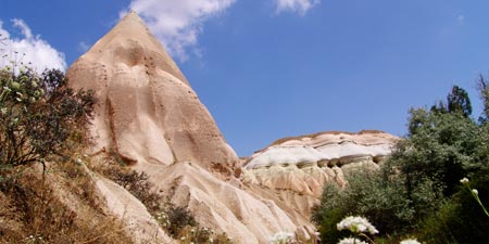
Our second night was also very comfortable and it was breezy enough to let us sleep. Then at the early hours of the day, we departed for the next valley.
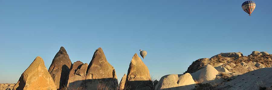
One of the more unknown regions is Central Anatolia (İç Anadolu), the actual historical heartland of the Turks. In terms of landscape, Central Anatolia is characterized not only by some wooded low mountain ranges, the Taurus Mountains in the southern part and the tuff landscapes of Cappadocia, but also by dry steppe areas of the inner Anatolian plateau. Central Anatolia is known for its hot summers (cold nights!) and frosty winters.
Worth seeing and of historical importance are the two former parliament buildings from the early republican period, which now serve as museums, and the old citadel in the city centre. The “Museum of Anatolian Civilizations (Anadolu Medeniyetleri Müzesi)”, known as the “Hittite Museum”, enjoys an international reputation as one of the most important archaeological museums in the world. Near the old town, in the Kocatepe district, rises the mighty Kocatepe Mochee, inaugurated in 1987.
A good 200 km south of the capital Ankara, the city of Konya is located on a plateau flanked by mountains up to 2,300 m high. The place, which was already populated in pre-Christian times, was the residence of the powerful Rum Seljuk sultans in the Middle Ages. Today Konya is known as a centre of conservative Islamic movements.
Eskişehir, surrounded by mountains and forests, is culturally influenced by its two major universities. The city, known for its meerschaum tradition (“Stone of Eskişehir”), boasts excellent cultural offerings such as opera performances, concerts and the annual “International Eskişehir Festival” as well as the “Kent Park” adventure park.
Until recently, the area's residents used the softness of the rock to build apartments, Christian religious buildings, storerooms and stables, as well as hiding places from marauding strangers. Over time, entire settlement complexes with up to 10,000 inhabitants emerged, some of which were connected by corridors. One of the most famous of these cave cities is Göreme, which was listed as a UNESCO World Heritage Site in 1985 and is located near Nevşehir.

Our second night was also very comfortable and it was breezy enough to let us sleep. Then at the early hours of the day, we departed for the next valley.
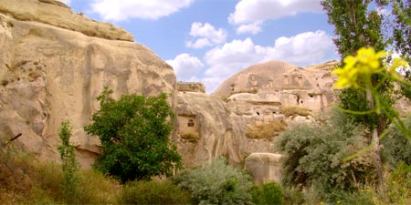
If you keep going through the alleyway after passing the Karakuş facilities through the Mustafapaşa Road at the west of Ürgüp, after a while you can reach Üzengi Stream which runs in parallel to the valley and where the water level isn’t so high. The valley also has an entrance from the direction of Ortahisar.
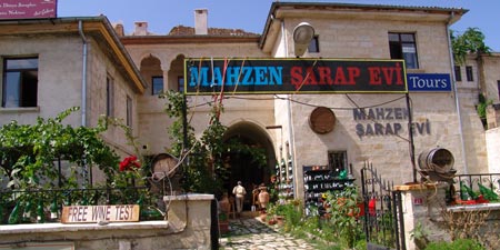
We saw very interesting wine house in the centre of Ürgüp whose garden wall was entwisted with many wine bottles. Entry of the house was also attractive.

On a Tuesday morning in the hot September season of Alanya, we took off to witness a few days of the internationally participated (Pal Takats, world champion in acrobatics, Mads Sydergaard, editor of Cross Country magazine, Olivier Laugero, world renown xcmag.com photographer, Fredegar Tommek, Fabrice Sibille) great sports event of paragliding shows in its first leg at Karaman.

As would be expected from a smooth running operation, the organizer of XC paragliding competition and our team took to the roads once more to observe preparations towards this year’s The World Air Sports Federation FAI approved XC World Series Paragliding events to take place at Karaman, and to visit the town of Mut, surrounds of which is mostly unknown to us as yet.

It was not a coincidence when I could beat Turkish Record with about 262 Kilometers in June 2010. Indeed, I fly since 20 years and my years of experience was a big part of this success.

First of all, we stopped by Avanos, which is Cappadocia’s handicrafts and pottery center, for lunch. This is an underground rock restaurant. Although when I looked from the outside I did not like it, dining hall of the restaurant was authentic and attractive. The residences that carved by damp-proof white rock are common in this region.

We are on the road from Karaman to Eregli on country road 350 as we turn to the right to direction Taşkale, a lovely nice little village in picturesque valley which belongs to Karaman about 40 kilometres away from the city.

We left Karaman in direction to Kilbasan on an asphalted country road leading to Karapinar. At Dinek we turned to the left, just after passing the massive 2.288 metres high former volcano Karadag, again on a metalled but smaller road, in direction to Madensehir just 30 kilometres to the north of Karaman.

Beyşehir is a large town and district of Konya Province in the Central Anatolia region of Turkey. The town is located on the south eastern shore of Lake Beyşehir and is marked to the west and the southwest by the steep lines and forests of the Taurus Mountains, while a fertile plain, an extension of the lake area, extends in the south eastern direction.

Really wonderful landscapes when passing through the Taurus Mountains
During the main season or on a Turkish public holiday, when all the resorts are bursting at the seams, the lakes of Beysehir, Egridir and Burdur, lying just behind the mountain range, offer quietness and relaxation.
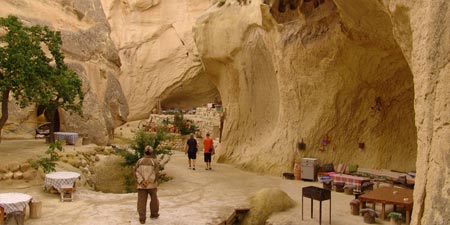
We decided to continue our journey. Balta’nın Yeri (Saklı Vadi), which is located near Mustafapaşa district (its old Greek name is Sinassos), waited for us. As we continued our journey with a car, it didn’t take long for us to realize why this place is called hidden valley.

Kayseri (first name was Mazaka, later name was Caesarea) ist he capital city of the region of the same name in Cappadocia in Turkey of about 500.000 inhabitants. Kayseri is one of the very few capitals of Turkey which number of inhabitants is not increasing rapidly during the last years.

The city of Kayseri, the Roman Caesarea, extends at the foot of the Erciyes Mountains (3,916 meters), an extinct volcano and well-known winter sports centre with good hotels and slopes.
Madrasa comes from ancient Latin and, directly translated, means 'place of education', ie. a school or training centre for skills. Used in this way, it means higher education in the Islamic religion.

Esenboğa International Airport (IATA: ESB, ICAO: LTAC) Turkish: Ankara Esenboğa Havalimanı, is an airport in Ankara, the capital city of Turkey. It has been operating since 1955. The name of the airport comes from the village of Esenboğa, which literally means "healthy bull".

The bizarre Avanos Hair Museum: a small cave containing hair samples, names and addresses of more than 16,000 women from all around the world. It was founded by Chez Galip, a talented potter from Avanos, a town famous for its pottery.

Near the village of Bogazkale, around 150 kilometres east of Ankara, you can visit the remains of Hattusa, the former capital of the Hittite empire, which was the ruling force in the 2nd millennium BC all over Anatolia and the northern part of today's Syria.

Sivas is a town in Central Anatolia, about 250 kilometres east of Ankara in the province of the same name. It's old Greek name was Sebasteia. The number of inhabitants was 278.000 in 1997.

We wanted to cover the few kilometres to Yozgat during this time tour through Central Anatolia to Konya and Kirikkale, because according to our information there are also very attractive landscapes and cultural-historical backgrounds that also go back to the Hittites.